North coast engineering
HOW DOES LAND SURVEYING WORK?
The Essential Role of Land Surveying: Measuring, Mapping, and Planning for the Future
Land surveying is a crucial process that involves the precise measurement and mapping of land to define boundaries, plan infrastructure, and develop properties. It plays a fundamental role in construction, urban planning, and legal matters. Whether you are building a home, designing roads, or resolving property disputes, land surveying ensures that everything is set on the right foundation.
Why is Land Surveying Important?
Land surveying is vital for many industries, including construction, real estate, and law. It helps define property boundaries, ensure compliance with regulations, and avoid costly mistakes in the planning and construction phases. A surveyor’s work provides the accurate data necessary for creating maps and models that influence everything from urban design to legal property ownership.
Key Types of Surveys
Boundary Surveys
These surveys are used to determine the exact boundaries of a property. They help property owners settle disputes, avoid encroachments, and define legal property lines. Knowing your boundaries is crucial when building or selling a property, as it ensures that all structures are within the legal limits.
Topographic Surveys
Topographic surveys provide essential information for architects, engineers, and city planners. These surveys map out the physical features of a land area—such as elevations, utilities, roads, and structures—giving a comprehensive view of both natural and man-made elements. With this information, planners can make informed decisions when designing infrastructure or determining how best to use the land.
Construction Surveys
These surveys are performed to lay out the physical locations of new buildings, roads, utilities, and other infrastructure. Construction surveys help translate architectural designs into the real-world coordinates on the ground. Contractors and equipment operators rely on precise construction stakes to avoid costly mistakes during construction. Accurate surveys ensure that structures are built in the correct locations, reducing risks and improving efficiency.
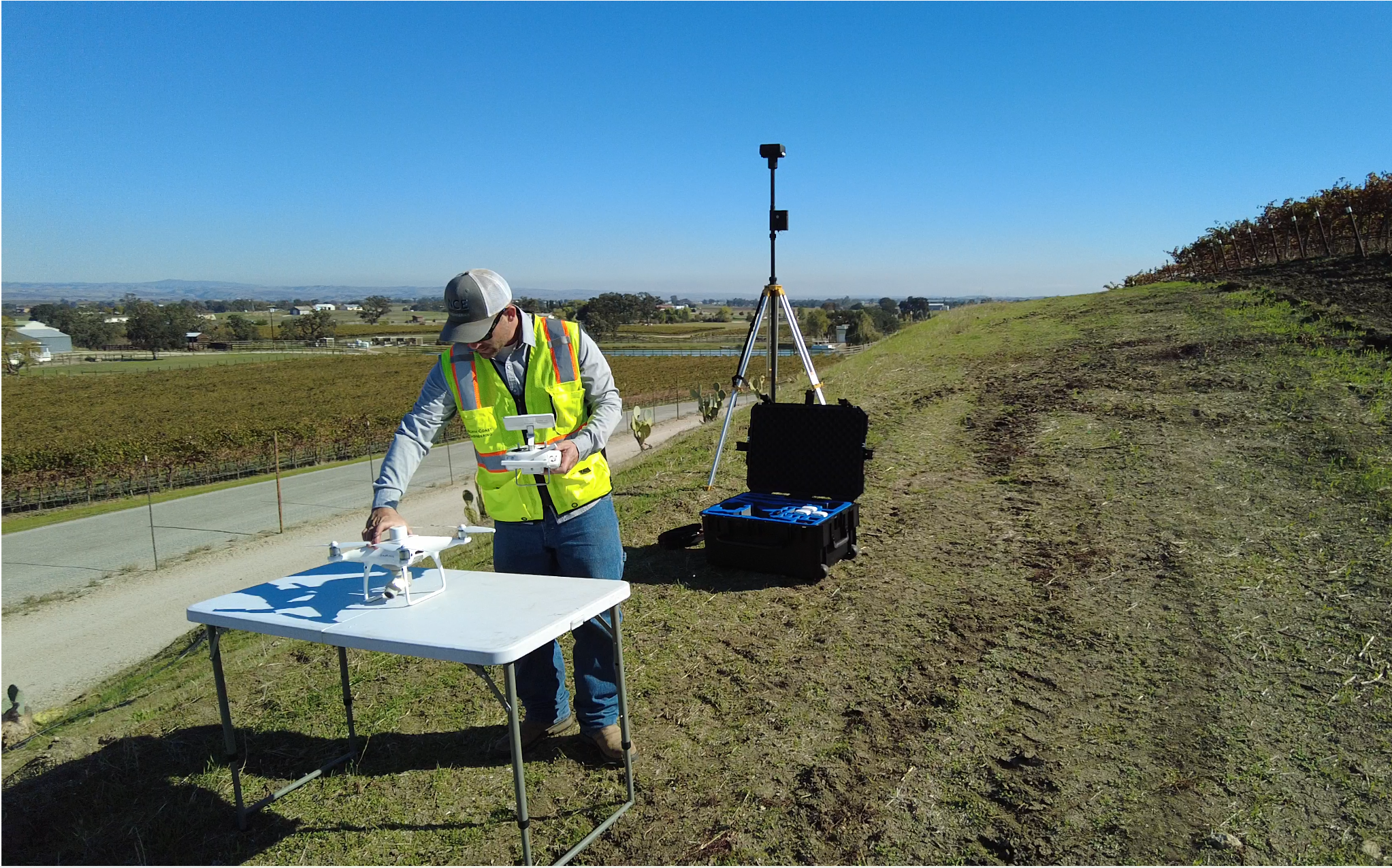
Aerial Surveys
Aerial surveying uses drones, planes, or helicopters equipped with cameras and LiDAR (Light Detection and Ranging) to capture highly detailed topographic data from above. Aerial surveys can quickly map large or hard-to-reach areas, creating 3D models with a high level of detail.
Tools of the Trade: The Technology Behind Land Surveying
Land surveying has evolved significantly over the years, thanks to advances in technology. Today, surveyors use a variety of tools to ensure accuracy and efficiency in their work:
Theodolite/Total Station
The theodolite and total station are traditional but highly effective tools used by surveyors to measure angles and distances accurately. These instruments establish precise networks of coordinates using electronic measurements, but they require a direct line of sight to the target. Total stations can also collect data and store it digitally, speeding up the process.
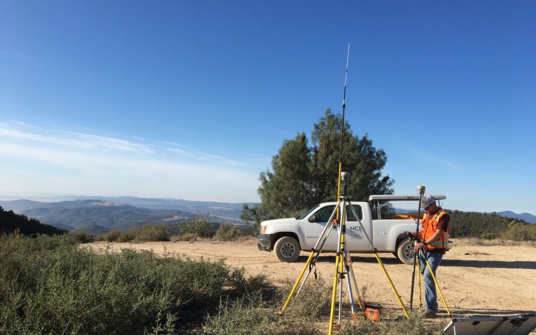
Global Positioning System (GPS)
GPS technology has revolutionized land surveying. By using satellite signals, GPS systems can provide highly accurate geodetic coordinates without requiring line-of-sight. Surveyors can access the National Spatial Reference System and State Plane Coordinates to map out locations efficiently. GPS is particularly useful for large-scale surveys or areas where visibility is limited.
Laser Scanners
Laser scanning, or LiDAR (Light Detection and Ranging), is a cutting-edge technology that uses lasers to collect vast amounts of 3D data points quickly and accurately. This method allows surveyors to capture detailed surface information in a short amount of time, making it ideal for complex or large-scale surveying projects.
How Does Land Surveying Work?
Surveyors create a detailed and accurate map by employing several methods and technologies. One essential aspect of the process is the establishment of a “control network.” This is a series of reference points with known coordinates that surveyors use to ensure consistency and accuracy across the project site.
The Resection
This technique involves placing surveying equipment in optimal locations to measure specific angles and distances from the surveyor’s reference points. The resection process helps orient the job site according to the project’s coordinate system, ensuring that all measurements are made from a consistent point of reference.
Global Navigation Satellite System (GNSS)
Surveyors use GNSS (including GPS) to place physical markers in the ground, which establish geodetic coordinates for the site. These coordinates help surveyors map out the area with high precision, though they must manage challenges like signal interference and “noise” from nearby structures or atmospheric conditions.
Why Accuracy Matters
In land surveying, even the smallest error can lead to significant consequences. Whether it’s defining property boundaries, constructing roads, or building bridges, precise measurements are critical to ensuring safety, efficiency, and legal compliance. A small miscalculation in surveying could result in costly delays, safety risks, or legal disputes.
The Future of Land Surveying
With the continuous advancement of technology, modern land surveying has become faster and more accurate than ever before. Drones, laser scanners, and sophisticated GPS systems are just the beginning. Surveyors are now equipped to handle increasingly complex projects and provide high-resolution, 3D models of the land.
The future of land surveying looks promising, with innovations such as real-time data collection, autonomous surveying equipment, and even artificial intelligence applications enhancing the precision and efficiency of the industry.


Land surveying is more than just a technical job—it’s the foundation upon which our built environment is created. Whether you’re designing a highway, constructing a building, or settling a property dispute, accurate surveying ensures that every aspect of your project is grounded in precision. As technology continues to evolve, land surveying will remain an indispensable part of planning, construction, and development, providing the accurate data needed to build the world around us.
MEET OUR TEAM

Greg Jaeger
President & CEO

John Luttman
Vice President & Principal Engineer, QSD/P

Tucker Sanders
Vice President & Survey Manager
Have a project in mind?
We would love to hear from you and show you what we can do for your next project.
nce@northcoastengineering.com
725 Creston Rd Suite C Paso Robles, CA 93446
+1 (805) 239 – 3127