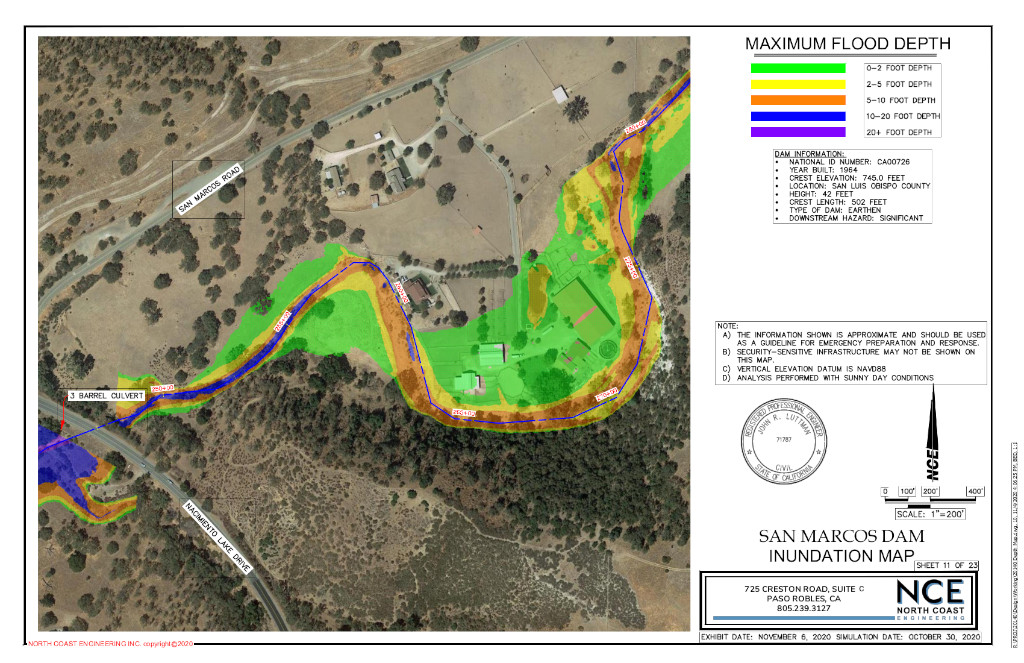
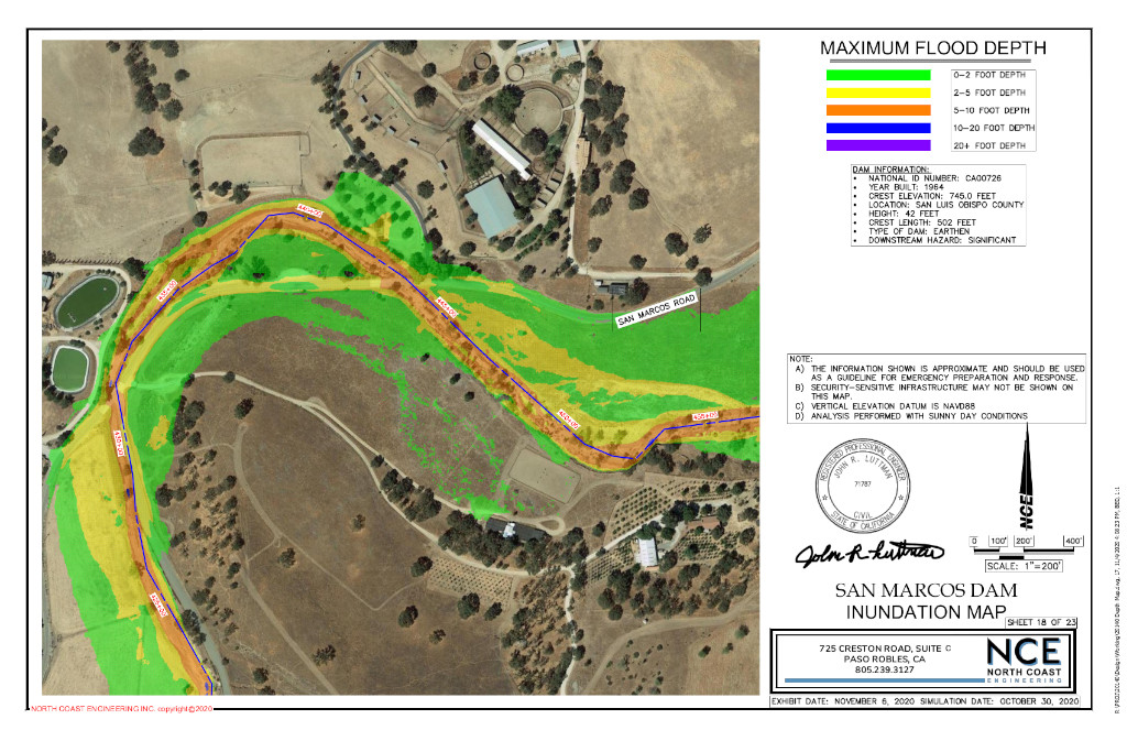
san marcos dam inundation map
size
10 Miles
location
San Luis Obispo County
completion year
2020
About this Project
North Coast Engineering completed the inundation map for the Department of Water Resources. The Department of Water Resources requires dam owners to perform a dam breach study every ten years to create an emergency response in case of failure. Our team modeled the breach of a 40-foot tall dam and the impacted area downstream from the dam. The simulation includes 407 acre-feet of water traveling over 10 miles through the San Marcos creek in just under two hours. NCE was able to map the inundated area in color pdfs for safety officials to prepare an emergency action plan (EAP) in response to a dam failure.


CLIENT
- CHIMNEY ROCK RANCH
PROJECT TYPE
- FLOOD MAPPING
SENIOR STAFF / PROJECT MANAGERS
- GREG JAEGER, P
PROJECT ENGINEER
- JOHN LUTTMAN, PE
services used
civil engineering
- Waterway Modeling / Flood Studies and Mapping
surveying & mapping
Surveying services were not used in this project.
project development
Project development services were not used in this project.

For A Full list of services
- Civil Engineering
- Land Surveying & Mapping
- Construction Staking
- Land Development
- Stormwater Management
HUERHUERO FLOOD ANALYSIS
SHANDON COMMUNITY PLAN FLOOD ANALYSIS
ALAMO SPRINGS SOLAR RANCH FLOOD CONSRAINT
ROBERT NICHOLS RANCH FLOOD STUDY
Have A Project in Mind?
We would love to hear from you and show you what we can do for your next project.
nce@northcoastengineering.com
725 Creston Rd Suite C Paso Robles, CA 93446
+1 (805) 239 – 3127
